Maps you can make from ready data
Follow tutorial-style examples built from public CSV and GeoJSON sources that are already formatted for Basismap.
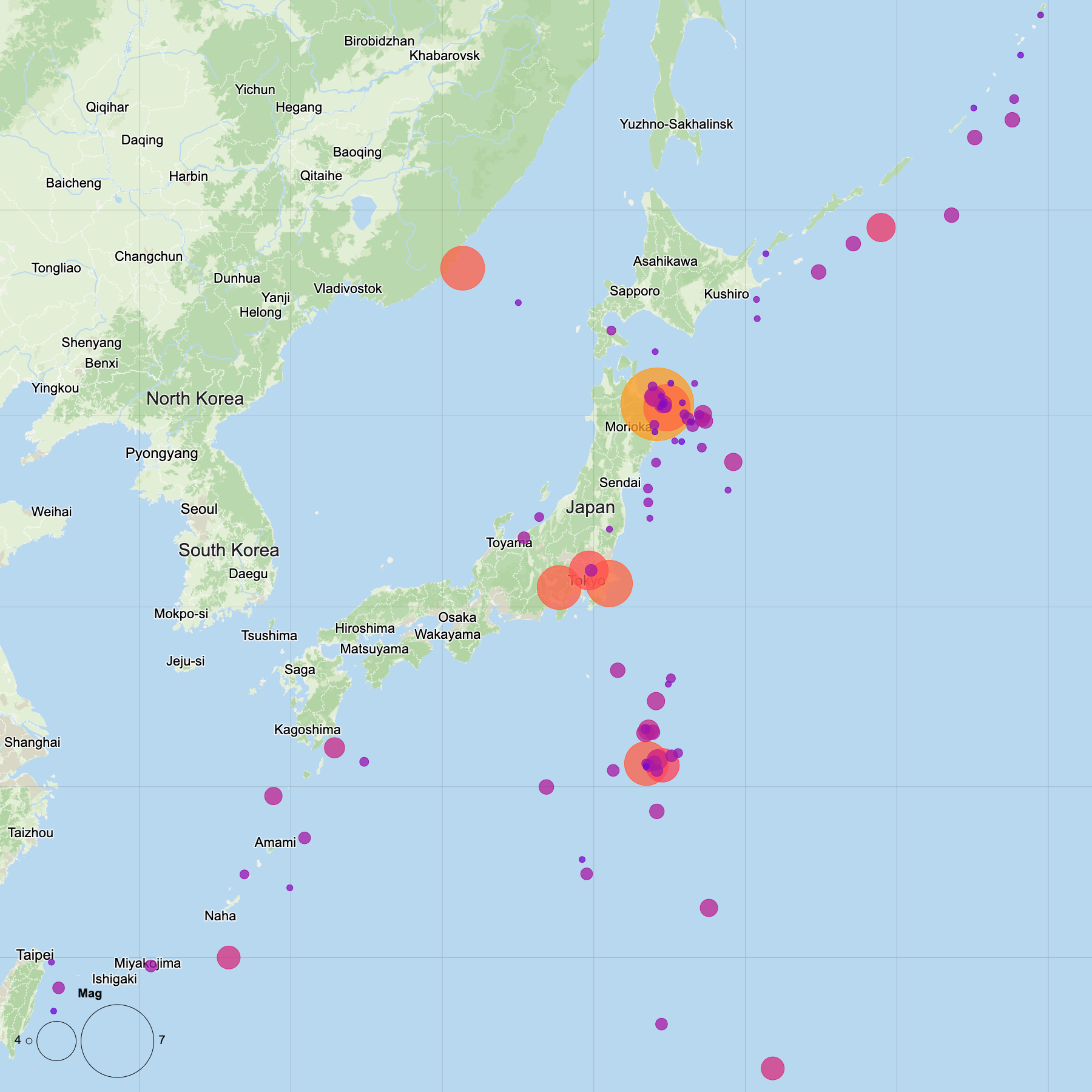
Live Earthquakes Near Japan
Map a public USGS GeoJSON feed and style earthquake points by magnitude, depth, or significance.
View workflow
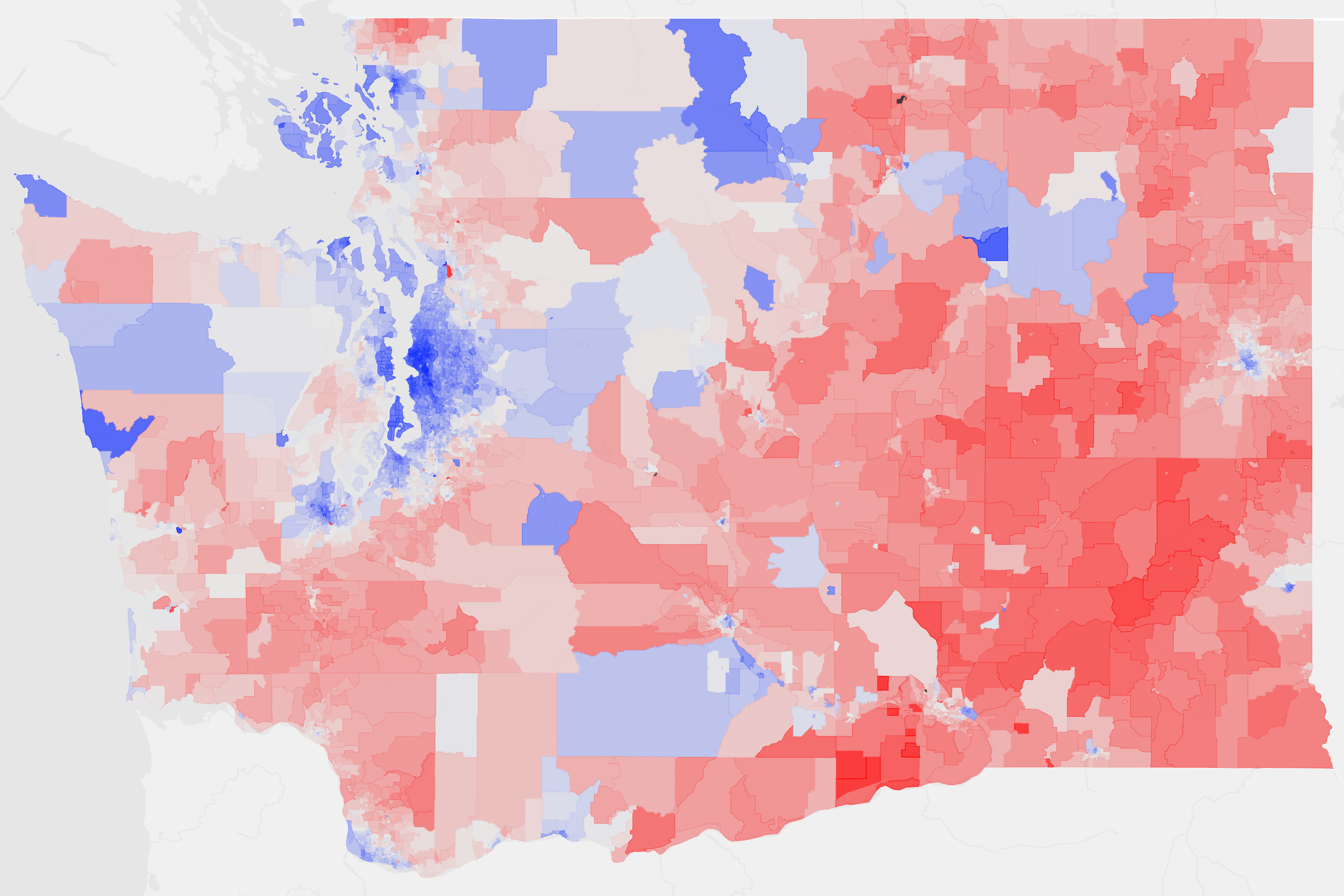
State Precinct Election Results
Build a state precinct map from 2020 election results and style partisan margins with a diverging red-blue scale.
View workflow
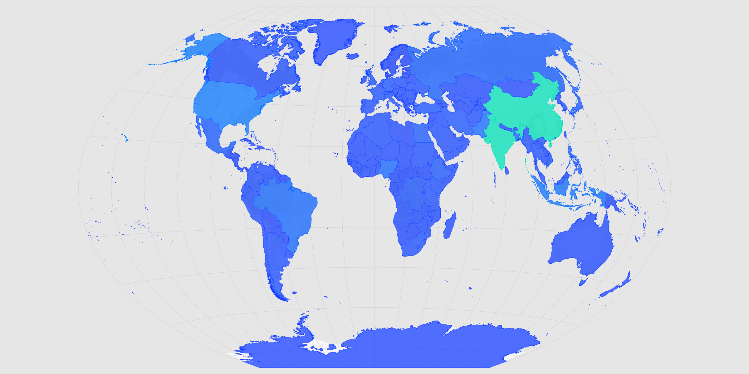
World Population Choropleth
Create a polished country-level population map from a ready-to-use Natural Earth GeoJSON file.
View workflow
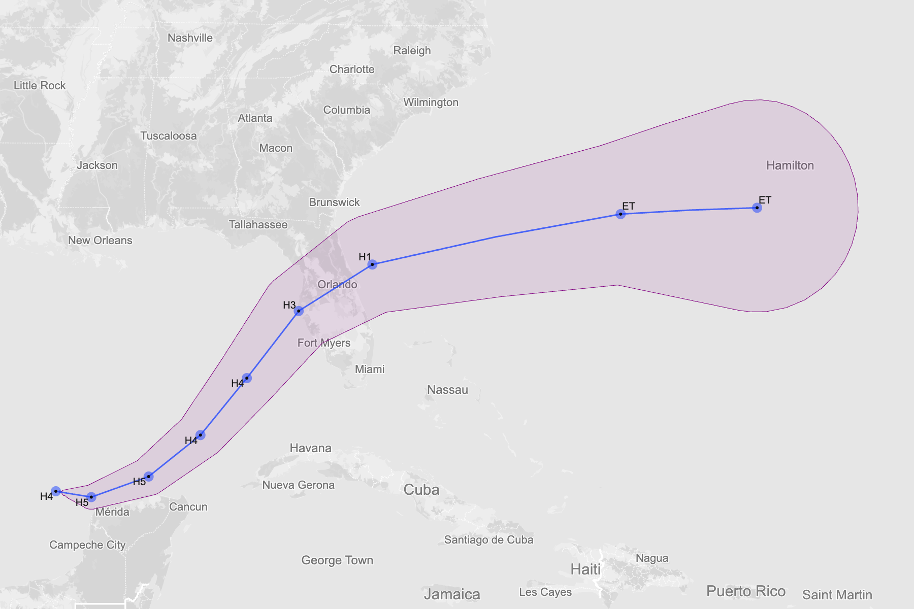
Hurricane Forecast Map
Build a hurricane track and forecast-cone map from advisory-based GeoJSON with points, lines, and a cone polygon.
View workflow
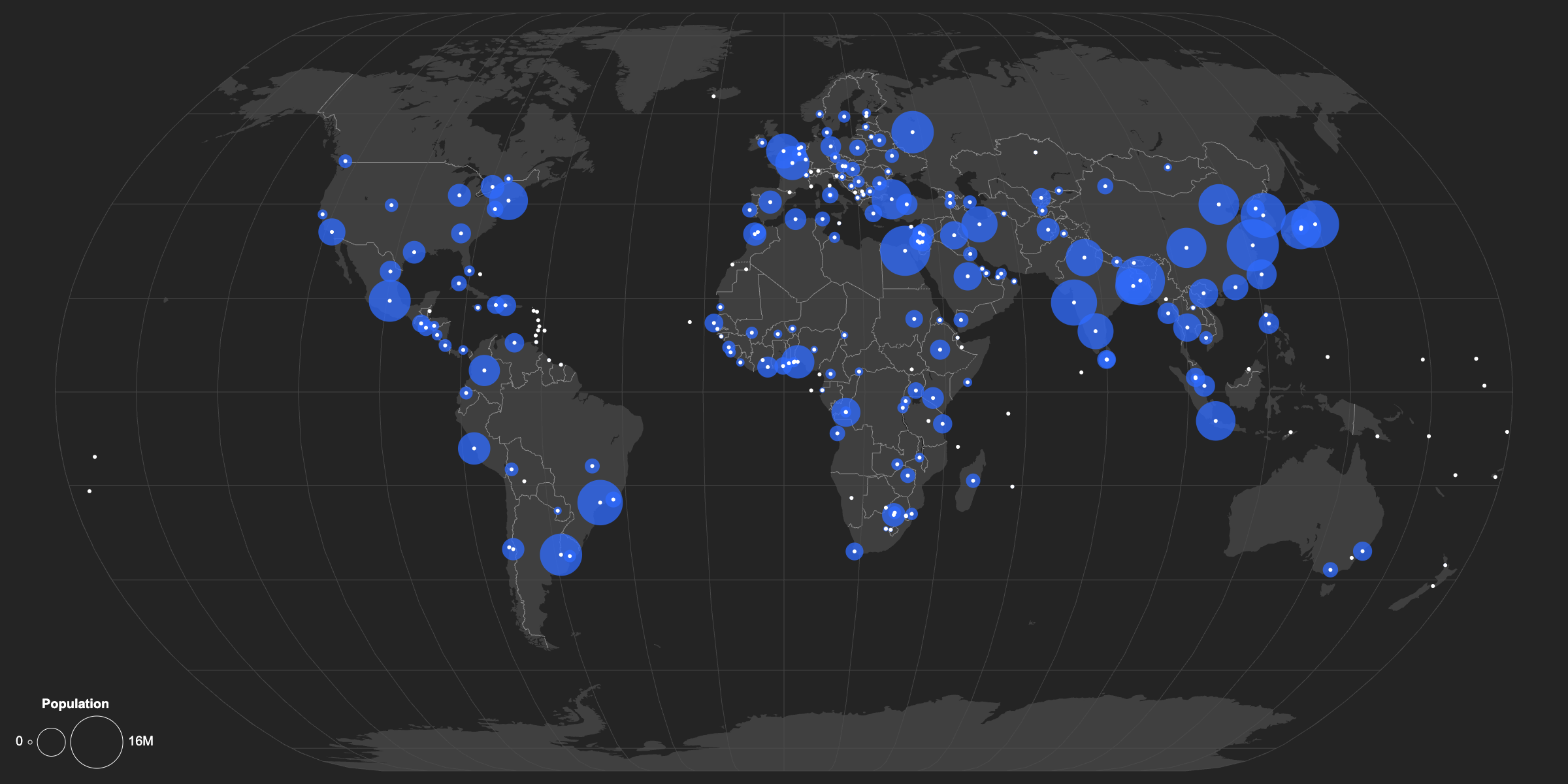
Global Cities by Population
Scale city points from a ready Natural Earth populated places GeoJSON file.
View workflow